Launch offer — valid today only

📄 Digital book in PDF · read it on your phone or print it

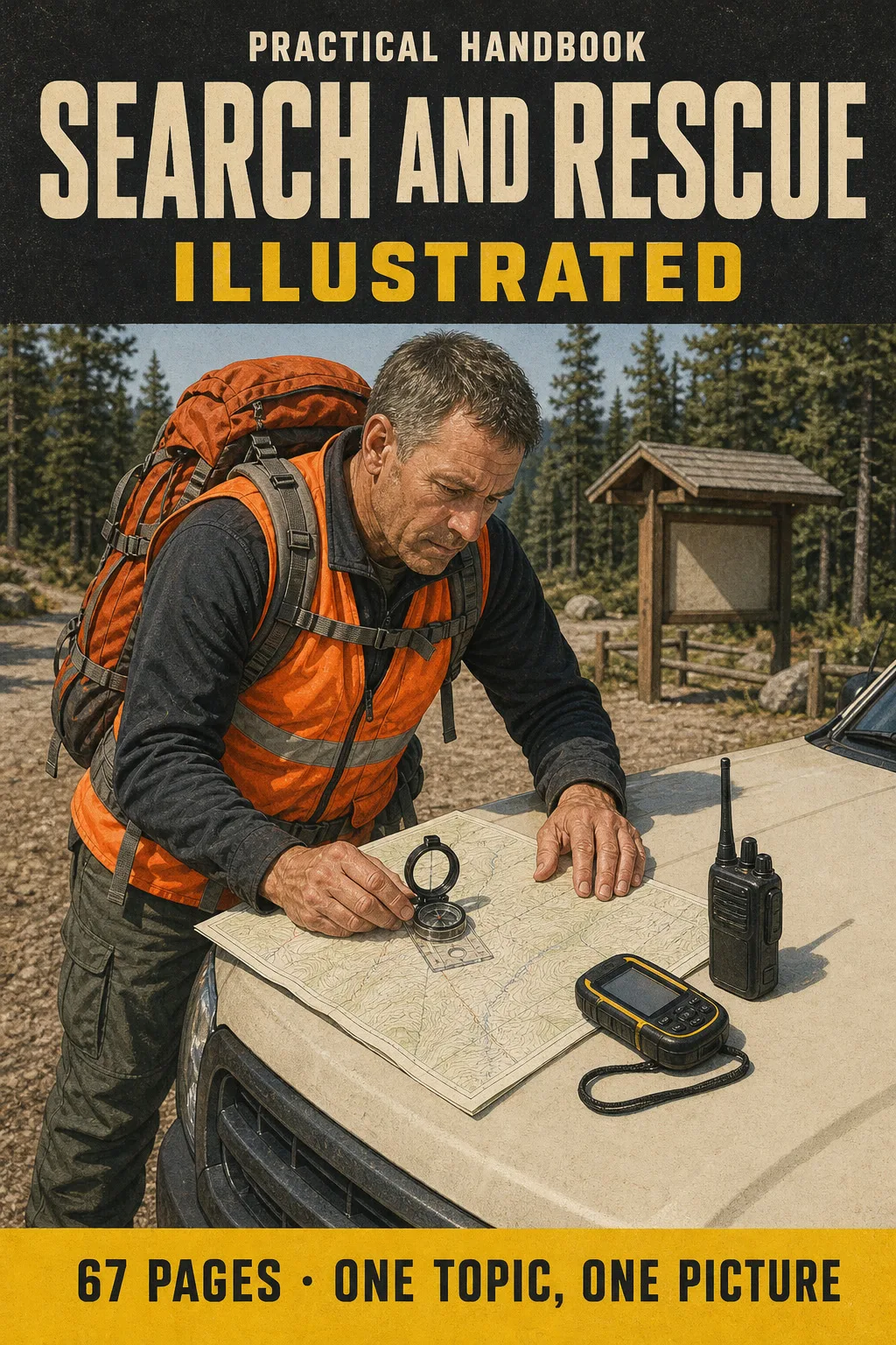
Map, Compass and Search Tactics for SARTECH II, All Illustrated Set a Bearing and Plot a UTM Point in the Same Order, Every Time

Topo maps, compass and declination, UTM and GPS, pace count, radio, incident command, lost person behavior, search tactics and clues. Every topic gets its own page: the drawing first, then what you need to remember. 67 illustrated pages.

START STUDYING THIS WAY

🔒 Secure checkout · PDF by email · 30-day guarantee

Every topic, its own pageEvery bearing, search pattern and checklist drawn, with the explanation right beside it
67 illustrated pages9 parts, from where the SAR searcher fits to the night before the evaluation
Up-to-date sourcesSARTECH II study materials, FEMA ICS-100 and USGS topo map standards
PDF by emailFormat

Look Inside the Book

Every page has one big drawing and a box with the steps and numbers you need to know:

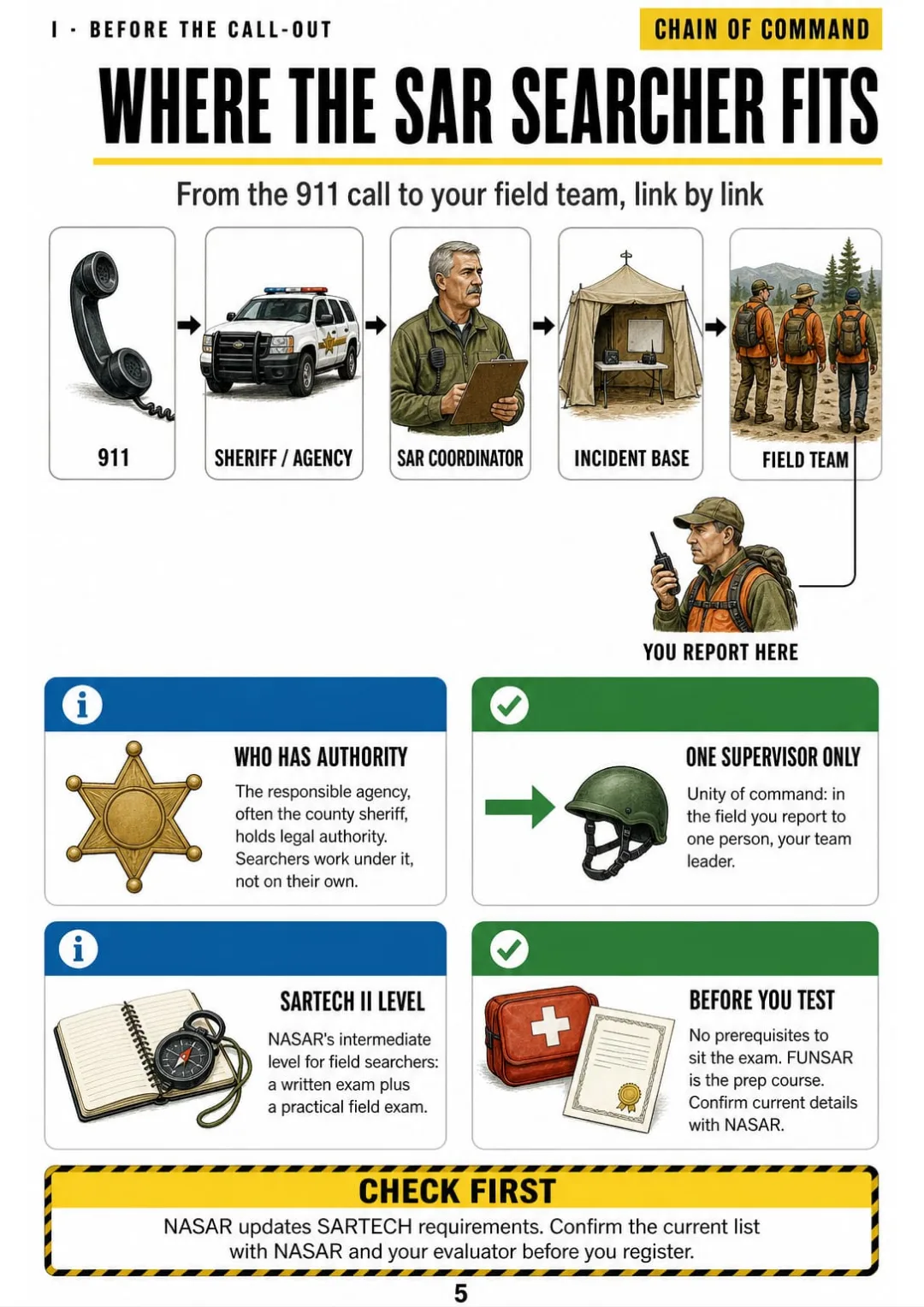
911 → agency → SAR coordinator → incident base → your team leader
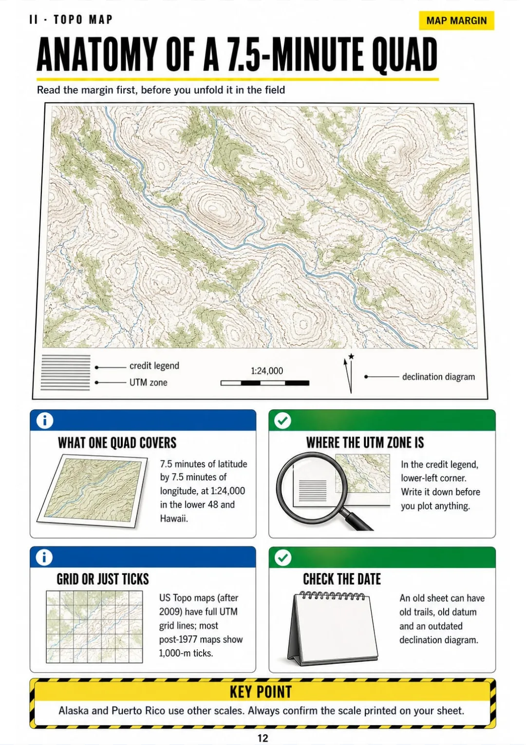
7.5' × 7.5' at 1:24,000: scale, interval, date, zone and declination, all in the margin
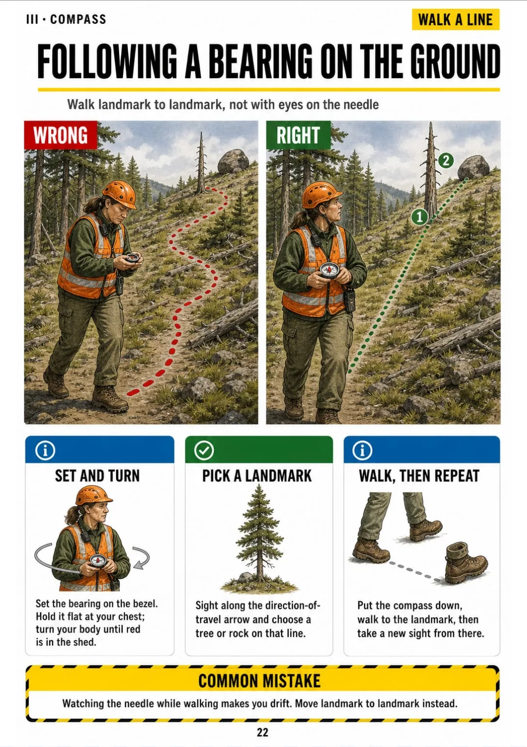
Following a bearing: body turn, landmark, walk, repeat.
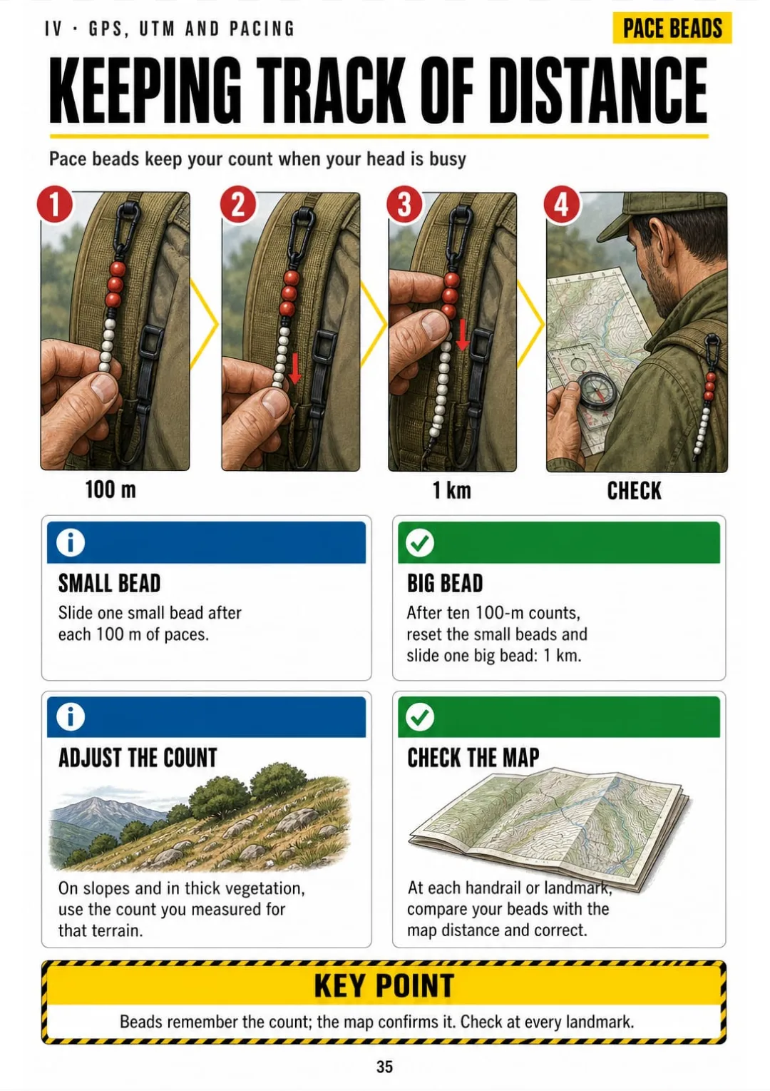
Pace beads: small bead every 100 m, big bead every kilometer, checked against the map
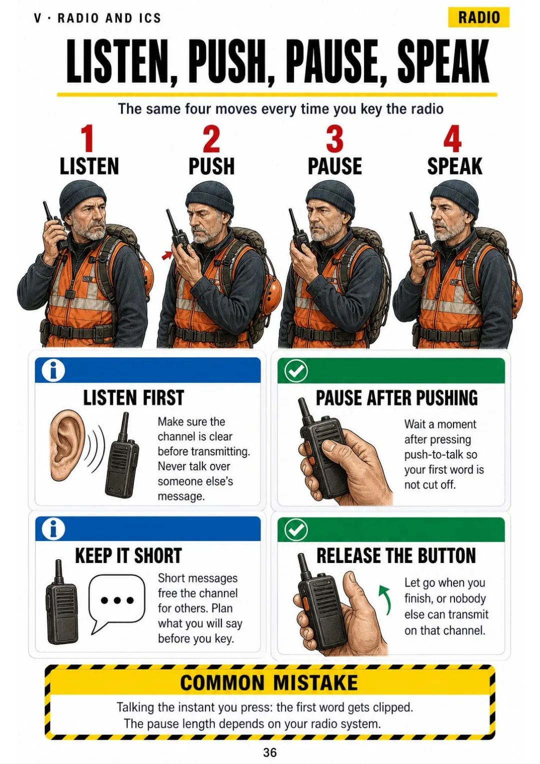
Listen, push, pause, speak, release: radio basics drawn in four panels
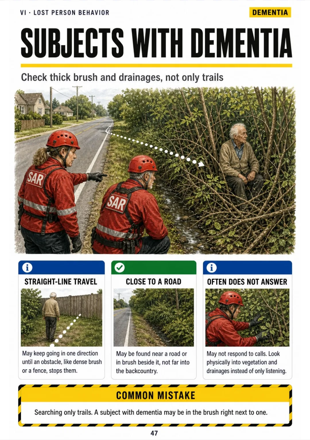
Dementia subjects: straight-line travel, near roads or in brush, often no answer
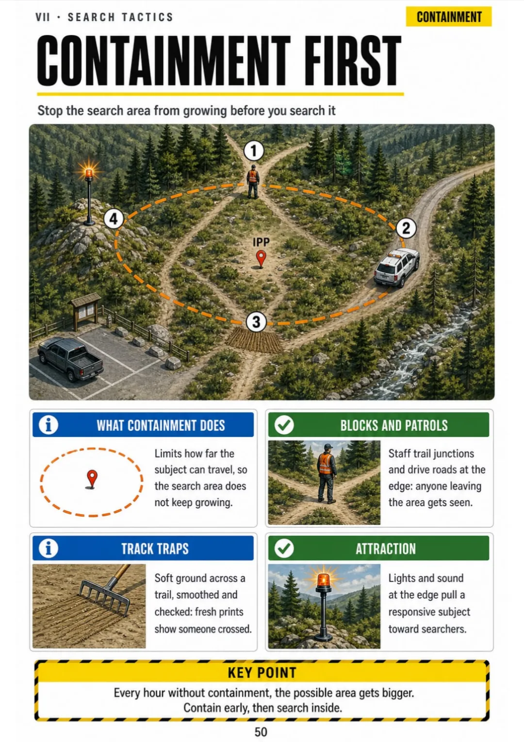
Containment: trail blocks, road patrols, track traps and attraction around the IPP
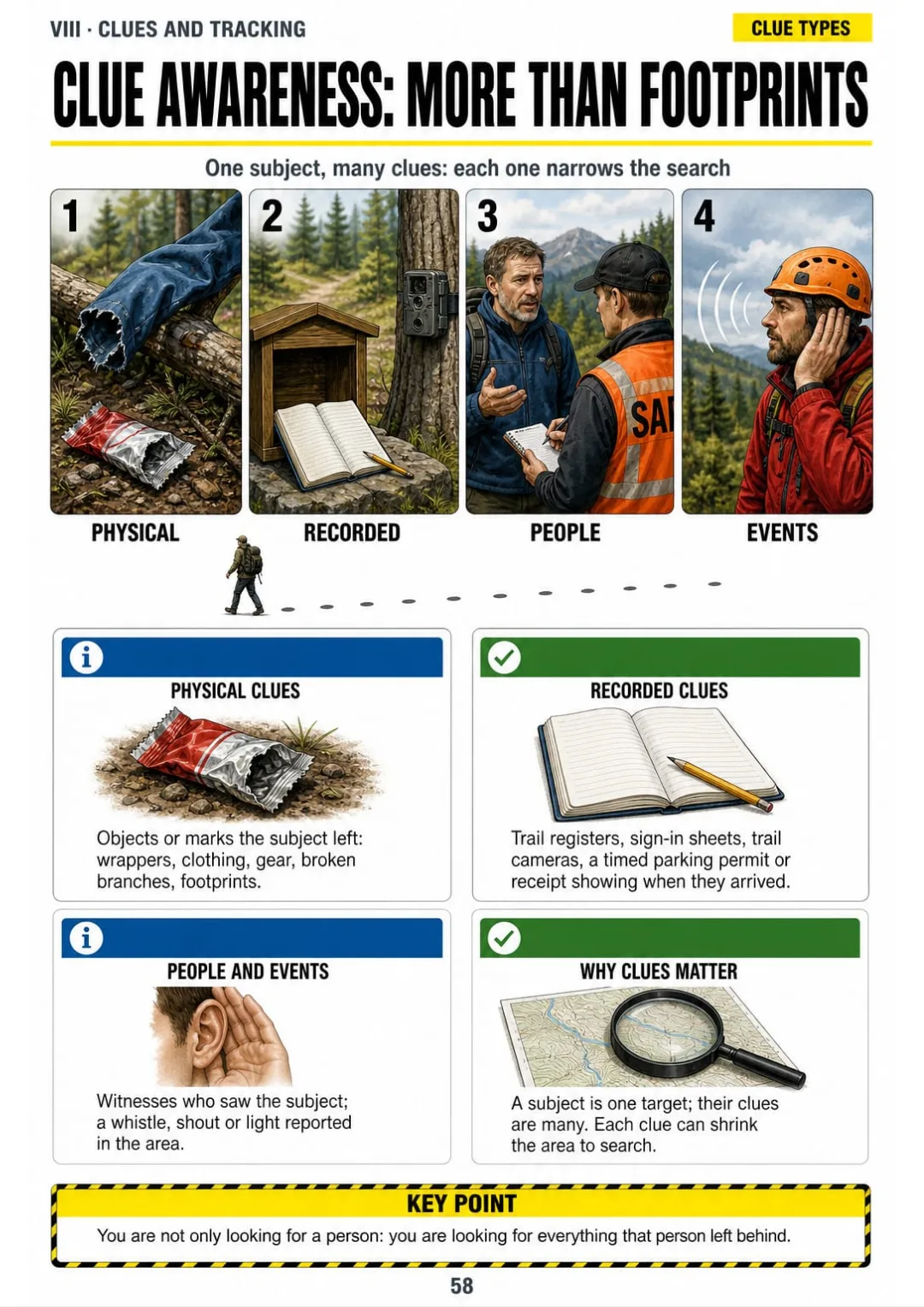
Physical, recorded, people and events: four clue types, one page

Swipe to see more →

These are real pages from the book. The table of contents is the full one: 9 parts and 63 topics.

The Problem Isn't You. It's How It Was Explained to You.

You're at the compass station. The evaluator hands you a baseplate compass and a map and asks for a bearing. You know you've done this, but your hands stop.

Which part turns, which arrow you line up, where you read the number. The course manual explains it in paragraphs, so the parts never got a fixed place in your head.

Following a bearing: body turn, landmark, walk, repeat.

In this book declination is one drawing: true north, grid north and magnetic north side by side, with the arrow that shows when you add and when you subtract, before you ever turn the bezel.

The same goes for declination math, back bearings, plotting a UTM point, the hasty search and what to do with a clue: each one has its own page.

You look at the page, you see where every part is, and you set the bearing without going back to the manual.

COMPARE FOR YOURSELF

The Same Topic, Two Ways to Study It

THIS
  • The manual: line after line of text
  • Map margins explained only in words
  • You show up to the evaluation with doubts
The USGS 7.5-minute quadrangle covers an area of 7.5 minutes of latitude by 7.5 minutes of longitude and is published at a scale of 1:24,000, whereby one inch on the map represents 2,000 feet on the ground. Marginal information, which the user must consult prior to any navigational task, includes the map name, the contour interval, the date of publication, the grid zone designation for the Universal Transverse Mercator system, and a declination diagram indicating the angular relationship between true north, grid north and magnetic north.
FOR THIS
  • The 7.5-minute quad in one drawing
  • Scale, interval and declination in a box
  • You see it and you get it
7.5' × 7.5' at 1:24,000: scale, interval, date, zone and declination, all in the margin
CONTENTS

Take a Look at the 9 Parts and 63 Topics

Before the call-out, the topo map, compass and declination, GPS, UTM and pacing, radio and incident command, lost person behavior, search tactics, clues and tracking, and the review before the evaluation: 67 pages, all illustrated.

IBefore the Call-Out · pp. 5-11
  1. Where the SAR Searcher Fits
  2. The 24-Hour Pack, Drawn as a Packing Diagram
  3. The Ten Essentials Behind the Pack
  4. Dressing in Layers for the Field
  5. Personal Safety Comes First
  6. Hypothermia and Heat Illness on the Trail
  7. Lightning, Water and Terrain Hazards
IIReading the Topo Map · pp. 12-19
  1. Anatomy of a 7.5-Minute Quad
  2. Scale: 1 Inch Equals 2,000 Feet
  3. Contour Lines Without Guessing
  4. Ridges, Valleys and Saddles
  5. Map Colors and Symbols
  6. Orienting the Map to the Ground
  7. Handrails, Catching Features and Attack Points
  8. Measuring Distance and Elevation Gain
IIICompass and Declination · pp. 20-28
  1. Parts of a Baseplate Compass
  2. Taking a Bearing From the Field
  3. Following a Bearing on the Ground
  4. Taking a Bearing From the Map
  5. What Declination Is
  6. Declination Math: Map to Field and Back
  7. Back Bearings
  8. Triangulating Your Position
  9. Detours Around Obstacles
IVGPS, UTM and Pacing · pp. 29-35
  1. Why SAR Uses UTM
  2. Reading a UTM Coordinate: Right, Then Up
  3. Plotting a UTM Point With a Roamer
  4. Setting Up the GPS Before You Go
  5. Marking Waypoints and Track Logs
  6. Your Pace Count
  7. Keeping Track of Distance in the Field
VRadio and Incident Command · pp. 36-42
  1. Radio Basics: Listen, Push, Pause, Speak
  2. The Call Format: Who You Call, Who You Are
  3. Phonetic Alphabet and Numbers
  4. ICS in One Org Chart
  5. Where the Field Team Sits in ICS
  6. Check-In, Briefing and the Task Assignment
  7. The Debriefing
VILost Person Behavior · pp. 43-49
  1. PLS, LKP and the IPP
  2. Why Profile the Subject
  3. How People Get Lost and What They Do
  4. Children by Age Group
  5. Subjects With Dementia
  6. Hikers and Hunters
  7. Responsive or Unresponsive Subject
VIISearch Tactics · pp. 50-57
  1. Containment First
  2. The Hasty Search
  3. Sound and Attraction Techniques
  4. Grid Search: How It Works
  5. Spacing and Critical Separation
  6. Running a Line Search
  7. POA, POD and POS Without Fear
  8. Segments and Search Assignments
VIIIClues and Tracking · pp. 58-62
  1. Clue Awareness: More Than Footprints
  2. When You Find a Clue: Stop, Mark, Report
  3. Protecting a Possible Crime Scene
  4. Sign Cutting and the Track Trap
  5. Step-by-Step Tracking With a Tracking Stick
IXReview Before the Evaluation · pp. 63-67
  1. The Written Exam: What to Review
  2. The Practical Stations, One Checklist Each
  3. Basic Knots at a Glance
  4. Ten Navigation Mistakes Drawn Wrong and Right
  5. The Night Before: Last Check

One Page, One Topic, All Clear

Think of it this way:

It's the practical evaluation. The evaluator gives you a UTM coordinate and a quad, then waits for you to put your finger on the point.

In the book you open the UTM page and see it drawn: 60 zones of 6°, coordinates in meters, read right, then up, and the 1,000-meter squares printed on the quad.

Listen, push, pause, speak, release: radio basics drawn in four panels

Same with the declination math, the 24-hour pack, the ICS org chart, the hasty search and what to do with a clue: each one sits on its own page.

Search and Rescue Illustrated is 67 pages in 9 parts, all drawn, and it ends with a written exam review, one checklist per practical station and ten navigation mistakes. The bonus “15 Field Mistakes, Before and After” covers the errors beyond navigation.

What you see drawn, you don't have to memorize.

What's Inside Search and Rescue Illustrated:

Ipp. 5-11

Before the Call-Out

Where the SAR searcher fits, the 24-hour pack as a packing diagram, the ten essentials, layers, personal safety, hypothermia and heat illness, lightning, water and terrain hazards.

IIpp. 12-19

Reading the Topo Map

The 7.5-minute quad, the 1:24,000 scale, contour lines, ridges, valleys and saddles, colors and symbols, orienting the map, handrails and attack points, distance and elevation gain.

IIIpp. 20-28

Compass and Declination

The baseplate compass in one labeled drawing, so you take a bearing from the map or the field in the same order every time. Plus declination math, back bearings, triangulation and detours, one page each.

IVpp. 29-35

GPS, UTM and Pacing

Why SAR uses UTM, reading and plotting a coordinate with a roamer, GPS setup, waypoints and track logs, your pace count and keeping track of distance.

Vpp. 36-42

Radio and Incident Command

Listen, push, pause, speak, the call format, the phonetic alphabet, ICS in one org chart, where your team sits, check-in, briefing, task assignment and debriefing.

VIpp. 43-49

Lost Person Behavior

PLS, LKP and the IPP, why you profile the subject, how people get lost, children by age, dementia, hikers and hunters, responsive or unresponsive subjects.

VIIpp. 50-57

Search Tactics

Containment, the hasty search, sound and attraction, grid search, spacing and critical separation, line search, POA, POD and POS, segments and assignments.

VIIIpp. 58-62

Clues and Tracking

Clue awareness, stop, mark and report, protecting a possible crime scene, sign cutting, track traps and tracking with a tracking stick.

IXpp. 63-67

Review Before the Evaluation

What to review for the written exam, one checklist per practical station, basic knots, ten navigation mistakes drawn wrong and right, and the last check.

At the end of the book: A written exam review, one checklist per practical station and 10 navigation mistakes drawn wrong and right.
Plus: 2 Free Books

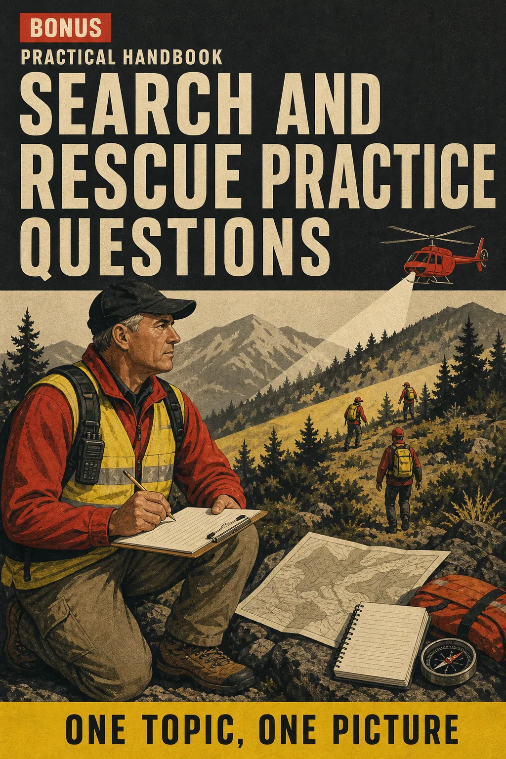
Search and Rescue Practice Questions

BONUS 1: «Search and Rescue Practice Questions»

Value on its own: US$ 17.90

Exam-style questions with the answer explained, so you find the gaps before the written test instead of during it.

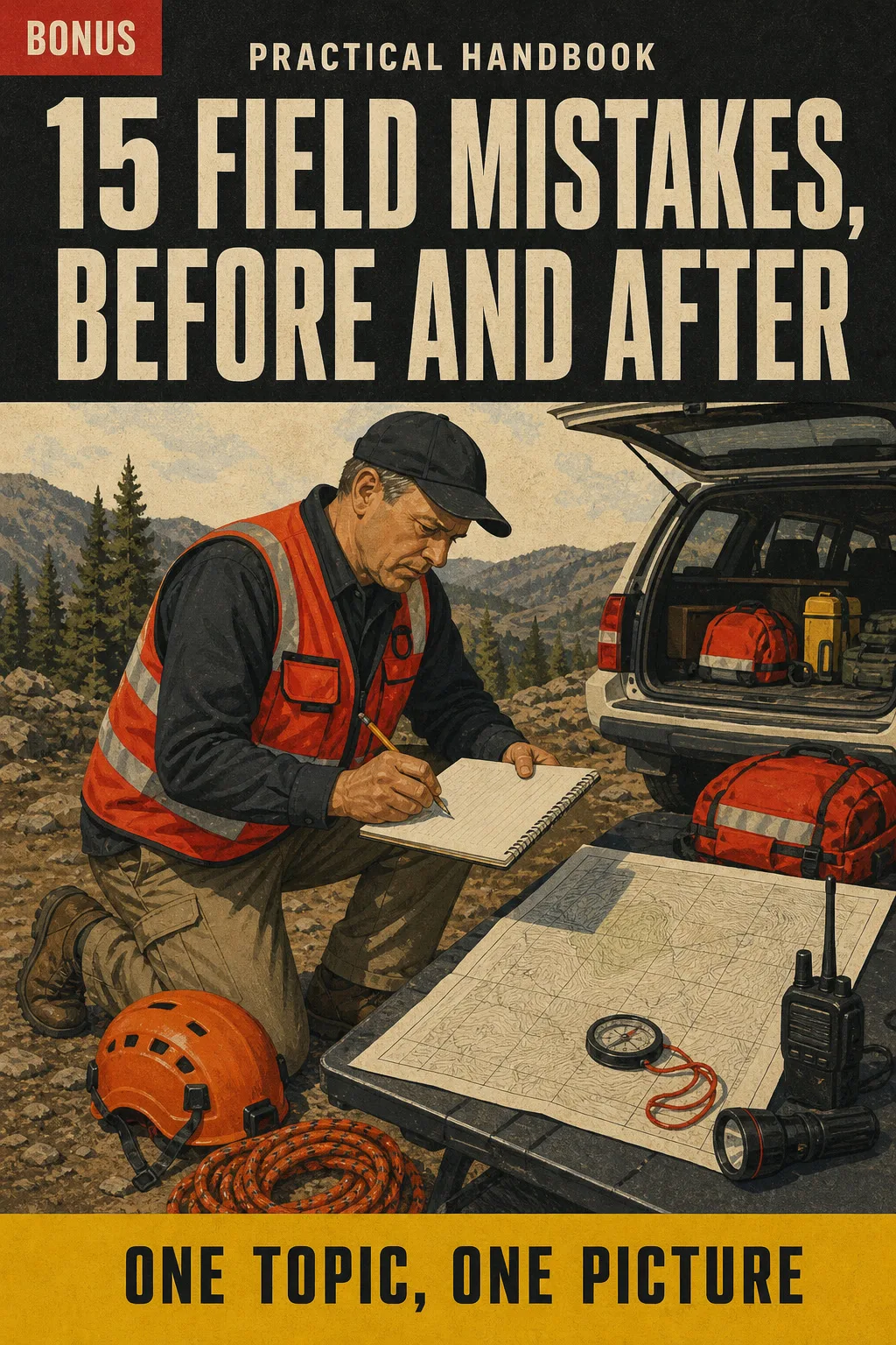
15 Field Mistakes, Before and After

BONUS 2: «15 Field Mistakes, Before and After»

Value on its own: US$ 14.90

The frequent errors in navigation, search tactics and clue handling, each drawn wrong and right, for a fast review the night before.

Search and Rescue Illustrated with 2 Free Books

  • Search and Rescue Illustrated: 67 illustrated pagesUS$ 63
  • BONUS 1: Search and Rescue Practice QuestionsUS$ 17.90
  • BONUS 2: 15 Field Mistakes, Before and AfterUS$ 14.90
  • High-resolution PDF to printIncluded
Total value US$ 95.80
YOUR PRICE:
US$ 27
You save US$ 68.80
YES, I WANT SEARCH AND RESCUE ILLUSTRATED FOR US$ 27

📄 This is a digital PDF book sent to your email: nothing is printed or shipped.

Secure purchaseEncrypted payment30-day guarantee

PDF by email: We email you Search and Rescue Illustrated as a PDF, together with the two free books. It's a single payment: no installments, no extra charges.

Who This Book Is For

You're studying for the SARTECH II

You're studying for the SARTECH II

Every skill is laid out in the same order: what it is, how to do it, the frequent mistake. You review one topic at a glance instead of rereading a chapter.

Your evaluation date is set

Your evaluation date is set

Part IX gives you what to review for the written exam and one checklist per practical station, and the practice questions help you find the gaps before the test.

You already go on callouts

You already go on callouts

Print the pages you need, like containment or clue handling, and review them before a callout or a recertification.

Everything You Get Today

US$ 95.80US$ 27
YES, I WANT SEARCH AND RESCUE ILLUSTRATED FOR US$ 27

📄 This is a digital PDF book sent to your email: nothing is printed or shipped.

30DAYS
GUARANTEE

30-Day Guarantee

Try Search and Rescue Illustrated for 30 days, bonus books included.

We refund everything if the file won't open, if the book isn't what you see here, if you were charged twice or if the email doesn't arrive. Just email us.

You pay once. No subscriptions.

Frequently Asked Questions

Is it for me if I'm preparing for the SARTECH II or already on a county SAR team?

Yes. It's not a general survival book: it follows the SARTECH II field skills, from map and compass to clues. You already have the manual and videos; this puts each skill on one drawn page, always in the same order, so you review it at a glance. It starts from the basics and works as a review if you've already been on searches.

Where does the content come from?

It's checked against the current published SARTECH II study materials, FEMA ICS-100 training materials and USGS topo map standards. Station rules, intervals and local procedures are flagged so you verify them with your own team.

Is this official material?

No. It's an independent study book. It is not published, approved or endorsed by NASAR, FEMA or any agency.

Does it replace the course or team training?

No. It helps you review between trainings. It doesn't give you a certificate or count as training hours. Field skills are learned in the field with your team, and the first aid pages don't replace a certified first aid course or medical care.

Are the practice questions the ones on the exam?

No. They're written for this book, in the style of the written exam, to help you find gaps. They are not official exam questions.

How do I get it?

In PDF by email, at the address you enter at checkout. The 2 bonus books come the same way.

Do I have to pay every month?

No. It's a one-time payment.

Can I have it on paper?

Yes. It's a printable PDF: print the whole book or just the pages you want to carry in your pack.

How does the refund work?

You have 30 days. We refund everything if the file won't open, if the book isn't what you see on this page, if you were charged twice or if the email doesn't arrive: just email us.

Before You Close This Page

No more rereading the manual and keeping nothing.

Declination, bearings and UTM points: you see them drawn, and that's it.

You walk into the evaluation knowing where everything is.

Drawings make studying faster.

The book is right below.

One-time payment: US$ 27 · Guarantee: 30 days · PDF by email

YES, I WANT SEARCH AND RESCUE ILLUSTRATED FOR US$ 27

📄 This is a digital PDF book sent to your email: nothing is printed or shipped.